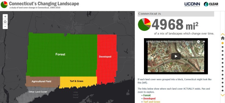
“Changing Landscape is a remote sensing-based land cover study that charts landscape changes in Connecticut and portions of New York. It covers the 25-year period from 1985 to 2010 (with in-between dates of 1990, 1995, 2002 and 2006). It includes information on basic land cover, as well as subsidiary analyses of riparian corridor land cover, impervious cover and agricultural field and soil analysis.”
Source: clear3.uconn.edu
This story map, created with the Story Map Journal application in ArcGIS Online, is a great example of how to use the “Story Action” features. Story Action features can move the map view to a particular location or change what is being displayed on the main stage of the story map. These can also be used to navigate to a different section of the a story map.
Here are two excellent Story Maps that use “Story Action” features. Please take some time to explore both of them and note how these features enhance the presentation of this spatial information:
- Connecticut’s Changing Landscape
- Damaged and Defiant: Houston Stories
- And just for fun, the Cross-Section of elevation along the meridians.
GeoEd TAGS: urban ecology, mapping, esri, storymap.


Leave a comment