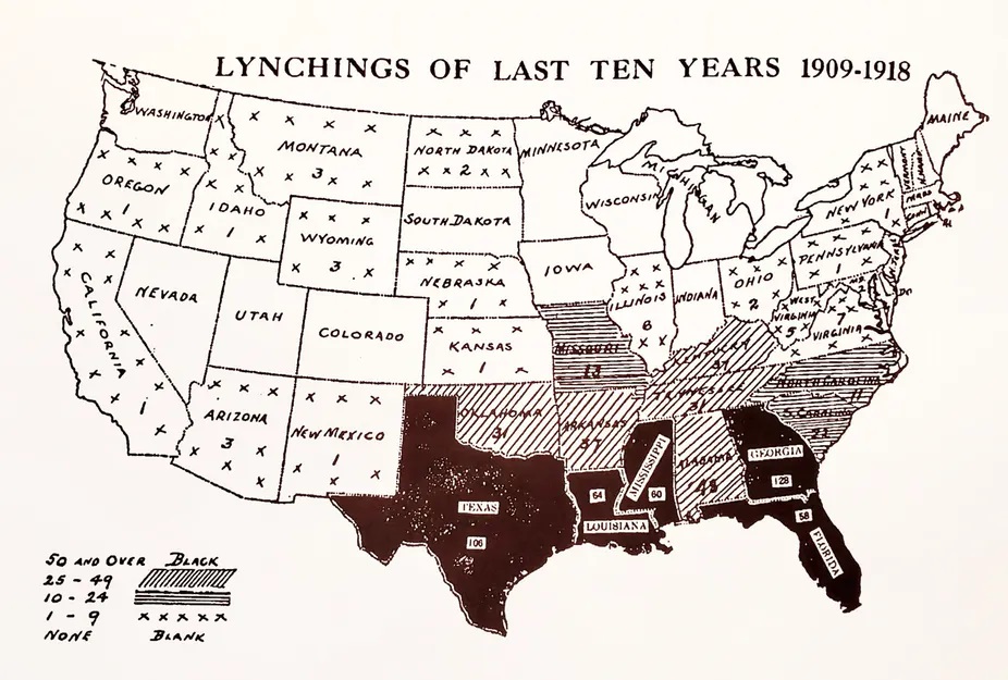
“How can maps fight racism and inequality? Maps are not ideologically neutral location guides. Mapmakers choose what to include and exclude, and how to display information to users.”
SOURCE: The Conversation
This article is written by two geography professors (@MLKStreet and @JoshGeog), but it is written for a general audience to learn about how cartography and geography can help us understand the historical impacts of racism on the landscape, and how cartography and geography can be a part of the solution. In a society with racism and official institutions upholding them, creating maps is an act of resistance and a path towards greater social justice within society. This article explores Black Panther resistance, redlining, counter-mapping, and modern digital maps that are shining a light of racial inequities.
Questions to Ponder:
- In what ways are maps biased sources of information?
- What is redlining?
- What impact does redlining still have on American cities?
- What is the purpose of counter-mapping?
- What value does diversity of mapmakers (both demographic characteristics of individual cartographers and of the organizations creating maps) have on the production of knowledge?


Leave a comment