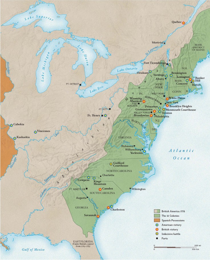
America’s war for indpendence began on April 19, 1775, when the first shots were fired at Lexington and Concord in Massachusetts.
Tags: USA, historical, mapping, National Geographic.
Source: education.nationalgeographic.com
America’s war for indpendence began on April 19, 1775, when the first shots were fired at Lexington and Concord in Massachusetts.
Tags: USA, historical, mapping, National Geographic.
Source: education.nationalgeographic.com
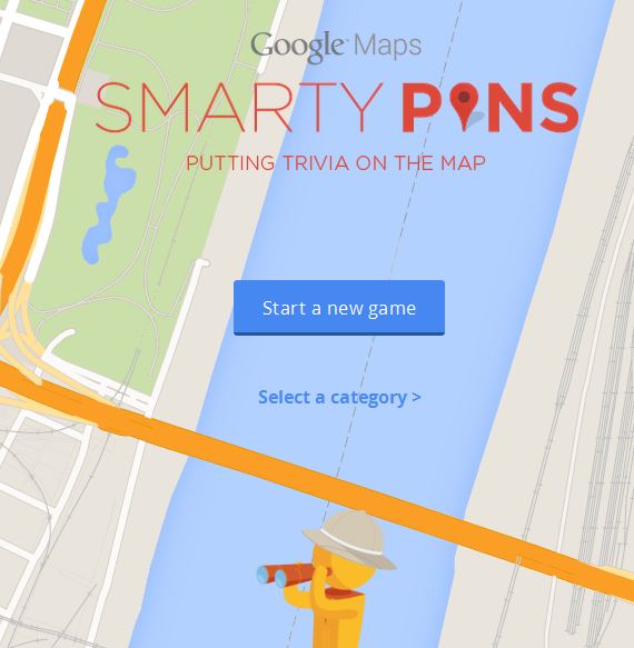
Smarty Pins is a Google Maps based geography and trivia game.
Source: smartypins.withgoogle.com
As stated in a review of Smarty Pins on Mashable, “Google unveiled a fun new game this week that tests players’ geography and trivia skills. Called ‘Smarty Pins’ the game starts players off with 1,000 miles (or 1,609 kilometers if they’re not based in the United States), and asks them to drop a pin on the city that corresponds with the correct answer to a given question.”
This game is wonderfully addictive…I haven’t enjoyed a mapping trivia platform this much since I discovered GeoGuessr. I answered 38 questions before I ran out of miles…how far did you get?
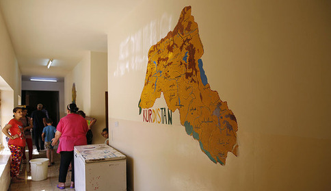
As the likelihood of an independent Kurdish state on Turkey’s eastern border grows, Ankara is losing its historical resistance to the idea.
Developments in Iraq have left Turkey facing the prospect of an independent Kurdish state on its eastern border. Such an idea would have been abhorrent for Turkey a mere decade ago for fear that its existence would incite separation among its own restive Kurds. The standard Turkish narrative at the time was that an independent Kurdistan was a Western project aimed at destroying Turkey, an age-old ambition. Even the 2003 US invasion of Iraq was viewed in this context by many. The picture is no longer so black and white.
Tags: Iraq, Turkey, MiddleEast, conflict, political, borders, devolution.
Source: www.al-monitor.com

“With seven billion people now living on Earth, the ever growing demand is putting unprecedented pressure on global resources—especially forests, water, and food. How can Earth’s resources be managed best to support so many people? One key is tracking the sum of what is available, and perhaps nothing is better suited to that task than satellites.”
Source: earthobservatory.nasa.gov
Agricultural production is one of the ways in which people modify the environment more than any other. Global population is expected to top out at around 9 billion around 2050, so will we be able to sustainably feed all of the entire human population? Satellite imagery can help answer these questions.
Tags: remote sensing, geospatial, images, sustainability, agriculture, food production, environment modify, unit 5 agriculture.
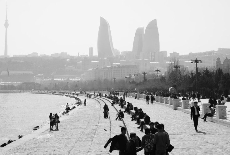
“Since 2006, when the opening of the Baku-Tbilisi-Ceyhan pipeline prompted a surge in crude oil exports — up to a million barrels a day travel through neighboring Georgia and on to Turkey and the West — there’s been no shortage of cash in Baku. Now, the city is eager for the prestige that goes with it.”
Source: www.bloomberg.com
Baku is described in this article as an East-West, socialist-capitalist, Muslim-secular, ancient-modern mishmash due to the numerous cultural and political interactions that it has had. This makes for a fascinating cultural landscape emerging in a city that has been dubbed “the Dubai of the Caucasus” but still has a rich Silk Road history. Caspian Sea oil lies at the heart of Azerbaijan’s geopolitical importance and cultural aspirations.
Tags: Azerbaijan, political, Central Asia.
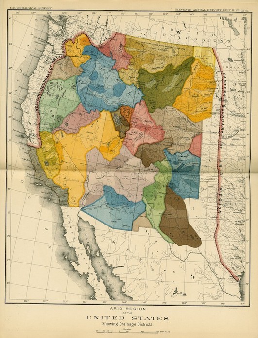
Today’s drought-riven west would look very different if Congress had listened to John Wesley Powell
Source: www.newrepublic.com
Author of Mapping the Nation, Susan Schulten explains how western expansion failed to recognize the basic physical geographic reality of the United States–that the west is much drier than the east. Given that much of the west, especially California, is in the midst of a severe drought, this article serves as a reminder to recognize that localized understandings of human and environmental actions are necessary. Do you know what watershed you live in? How does and should that impact us?
Tags: physical, historical, California, water, environment.
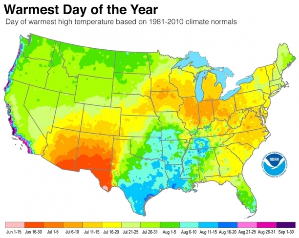
A new analysis shows when summer reaches peak heat across the U.S.
Tags: physical, weather and climate, seasonal.
Source: www.climatecentral.org

“NASA goes to the World Cup! Satellite imagery from each country playing.”
Source: www.arcgis.com
Not that we need any extra incentive to view NASA’s gorgeous satellite imagery, but now that the World Cup has entered the knockout rounds, it is the perfect opportunity to view selected images from the participating countries. This gallery of a dozen World Cup StoryMaps are but a few of the thousands of Esri StoryMaps that can serve as motivation to get your K-12 U.S. school an organizational account for ArcGIS online (then your students can make cool maps like these).
Tags: sport, Brazil, South America, Esri, fun, mapping, remote sensing, geospatial, images, perspective.
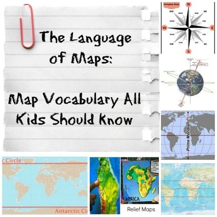
The vocabulary and concepts of maps kids should learn to enhance their map-skills & geography awareness. Concise definitions with clear illustrations.
Source: kidworldcitizen.org
I really like this article because it briefly shares the language needed for students to able to successfully use maps in the classroom…plus it’s highly adaptable for virtually any grade level.


