Search

GEOGRAPHY EDUCATION

Supporting geography educators everywhere with current digital resources.

Author

sethdixon

I am a geography professor at Rhode Island College.

How Many Earth-like planets are out there?

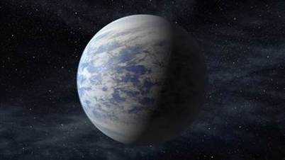
“Astronomers using NASA data have calculated for the first time that in our galaxy alone, there are at least 8.8 billion stars with Earth-size planets in the habitable temperature zone.  For perspective, that’s more Earth-like planets than there are people on Earth.”

Seth Dixon‘s insight:

I was recently flying over New York City and I was stunned at the vastness of this metropolis and amazed at the arrogance we take when we assume we ‘understand’ a place with millions of people and complex networks.  The geographic enterprise is remarkably ambitious and even if we can’t fully understand everything about our planet, we strive towards that goal…then I read this article and the magnitude of the universe simultaneously overwhelmed and inspired me.  8.8 billion earth-like planets!!  The only reason anyone could ever be bored is if they have stopped being curious about all that surrounds us.  

See on www.nbcnews.com

Maps and the Geospatial Revolution

Seth Dixon‘s insight:

This online course, Maps and the Geospatial Revolution, is designed to be an easy on-ramp to 21st century geospatial tools and any geography teacher hoping to modernize their skillset would do well to take this course (beginning April 30th) offered freely from the Program of Online Geospatial Education at Penn State, taught by Dr. Anthony Robinson.


Tags: GIS, teacher training, mapping, cartography, geospatial, edtech, geography education, unit 1 GeoPrinciples.

See on www.youtube.com

Geospatial

Climate Change at it’s most basic

http://www.HowGlobalWarmingWorks.org University of California

Seth Dixon‘s insight:

This NPR article highlighted this video and research that shows that a basic understanding of climate change is missing in our society (which opens up room for naysayers to think that all opinions are equally valid in a scientific discussion).

Eastern and Western Europe divided over gay marriage, homosexuality

Recent developments in Croatia and Scotland highlight a stark divide between Eastern and Western Europe on the topic of same-sex marriage.

Seth Dixon‘s insight:

Regions are fluid constructs that we use to think about places.  The region that we think of today as “Latin America” would not have been a discrete region 600 years ago since historical events have shaped the geographic evolution of the attributes of the region and the borders of world regions will continue to be redrawn.  Some have recently argued that since the end of the Cold War, the monikers Eastern and Western Europe are less meaningful in an economic context.   This map shows this old division can still be seen in this cultural/political context.  Some have argued that Russia’s recent move against gay rights is a geopolitical strategy to differentiate themselves from the West. 

TagsEurope, regions.

See on www.pewresearch.org

South Sudan factional fighting leaves hundreds feared dead

“Two days of street battles between rival factions in South Sudan‘s army left parts of the capital in ruins and prompted fears of a bloodbath in the world’s youngest country.

UN officials in New York said they had received reports from local sources indicating that between 400 and 500 people had been killed and up to 800 wounded. More than 16,000 people were seeking refuge at UN facilities. What began on Sunday night as an alleged coup attempt now threatens to widen deep ethnic divisions in a country awash with weapons and still recovering from a devastating war that led to its secession from the north in 2011.”

Seth Dixon‘s insight:

Earlier in the semester we discussed how difficult it is to establish a new country in a region with political and economic instabilty.  This is only further complicated by the presence of factional rivalries.  It’s a tragedy that these problems are being played out.  

Tags: South Sudanpolitical, Africa, states.

See on www.theguardian.com

In Florida, A Turf War Blooms Over Front-Yard Vegetable Gardening

A woman in Miami Shores is suing after her town insisted she remove vegetables from her garden.

Seth Dixon‘s insight:

This podcast highlights the political governance issues surrounding urban agriculture. 

See on www.npr.org

Rare snow storm hits Middle East

A rare snow storm hit the Middle East last week, producing record snows and extreme conditions for Syrian refugees.

Seth Dixon‘s insight:

Jerusalem recorded 15-20 inched of snow, while Cairo received it’s first snow in 112 years.  Just because something is rare or unlikely doesn’t mean that it can’t happen.  See this snowstorm as documented by satellite imagery here.    

See on earthsky.org

IsraelSnow

Geographic Midpoint Calculator, Find Your Personal Center of Gravity

Finds the exact point that lies halfway between two or more places. Find your personal center of gravity–the geographic average location for all of the places you have lived in.

Seth Dixon‘s insight:

This is a fun tool to make geographic analysis very personal.  You can also weight the importance of the locations based on the number of years stayed at a location.   For example, the map above is unweighted, but the map below reflects that most of my life was in the Western part of the United States.

See on www.geomidpoint.com

Updated

Concentrations of Wealth and Poverty

Seth Dixon‘s insight:

In this map, all Zip codes with more than 500 people are ranked from 0 to 99 based on household income and education.  The ‘Super Zips’ rank 95 or higher. The map at the top shows the highest concentration of the nation’s 650 Super Zips. The typical household income in a Super Zip is $120,272, and 68 percent of adults hold college degrees. That compares with $53,962 and 27 percent in the other zips mapped.  Washington D.C. shows a powerful bifurcation: One-third of Zip codes in the D.C. area are considered ‘Super Zips’ for wealth and education and large swaths of the metropolitan area are considered food deserts.

This weekend I had the privilege essentially flying from Boston to Washington DC at night and was mesmerized by the vast urban expanse beneath me.  It was the greatest concentration of wealth in the United States as well as the some of the most blighted regions of the country.  What explains the spatial patterns of highly concentrated wealth and poverty in the biggest cities?  Are cities a causal factor in wealth and poverty creation?  What does this zip code data tell us? What accounts for the spatial patterns in your region?    

Tags: Washington DC, urban, unit 7 cities.housing, economic, povertyplace, socioeconomic, neighborhood.

See on www.washingtonpost.com

Create a free website or blog at WordPress.com.

Up ↑