Search

GEOGRAPHY EDUCATION

Supporting geography educators everywhere with current digital resources.

Category

Scoop.it

Where Do Borders Need to Be Redrawn? – Room for Debate

What parts of the world should rethink their maps? Why and how?

Source: www.nytimes.com

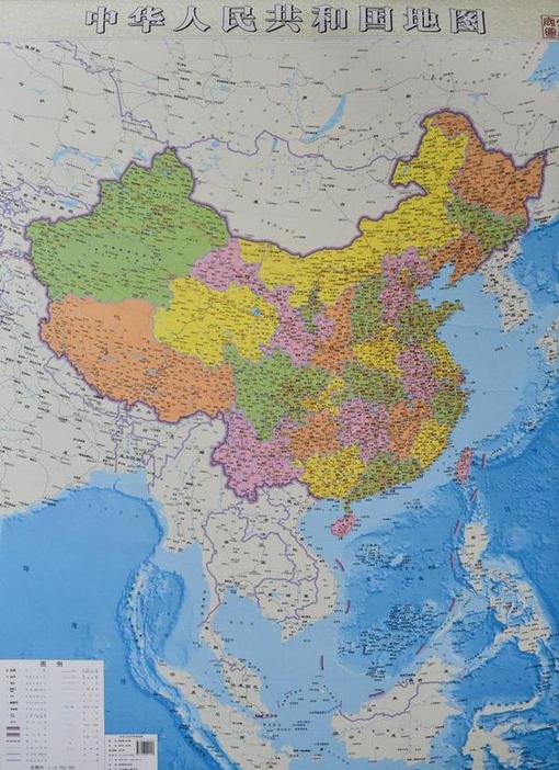
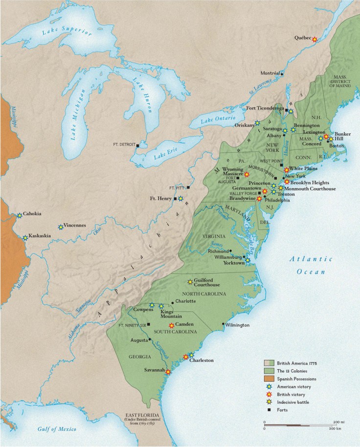
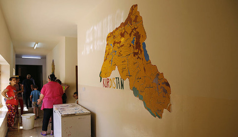
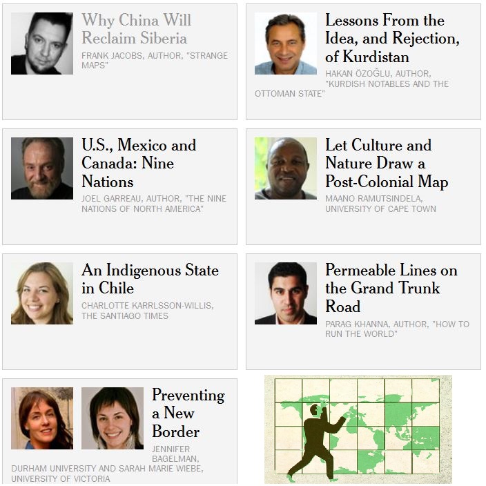
Maps are always changing as a new nation gets added and old lines cease to make sense. Territory is claimed and reclaimed.  This series of seven articles in the New York Times explores regional examples of how borders impacts places from a variety of scholarly perspectives.  Together, these article challenge student to reconsider the world map and to conceptualize conflicts within a spatial context.


Tags: bordersmapping, political, territoriality, sovereignty.

China’s hungry cattle feasting on alfalfa grown on Utah farm

China has long depended on the U.S. breadbasket, importing up to $26 billion in U.S. agricultural products yearly. But increasingly, Chinese investors aren’t just buying from farms abroad. They’re buying the farms.

Source: www.mcclatchydc.com

Globalization is often described as a homogenizing force, but is also pairs together odd bed fellows.  A small Utah town near the Colorado border, Jensen is now home to the largest Chinese-owned hay farm in the United States. Utah’s climate is right for growing alfalfa, and China’s growing cattle industry make this a natural global partnership.  Large container ships come to the United States from China, and return fairly empty, making the transportation price relatively affordable.  Locally back in the United States though, water resources are scarce and many see this as a depletion of local water exported to China.  Some states see this as a threat and are considering banning foreign ownership of farmland.  This article shows the merging various geographic themes: the global and local, the industrial and the agricultural, the human and the physical.         

Tags: agriculture, agribusinesstransportation, globalizationwaterChinaindustry, economic, physical, Utah.

China publishes new map

China has published a new map of the entire country including the islands in the South China Sea (West Philippine Sea) in order to “better show” its territorial claim over the region.

Source: globalnation.inquirer.net

China is attempting to bolster its geopolitical claims through cartographic validation.  It as if to say, ‘it’s on a map, who can question that it is legitimately our territory?’  Why is a map such a powerful and convincing document?  Why is the Philippines upset by this map?  I think that explains this rival Filipino map as the Philippines and China engage in the cartographic version of dueling banjos.  (note the uage of the South China Sea or West Philippine Sea to refer to the same body of water) .  But this is more than just a map; it’s production has the potential to destabilize regional security.     

For more resources, the Choices Program has put together supplemental materials to investigate China on the world stage.

Tags: borderstoponyms, political, conflict, waterChina, East Asia.

The tragedy of the Arabs

“A THOUSAND years ago, the great cities of Baghdad, Damascus and Cairo took turns to race ahead of the Western world. Islam and innovation were twins. The various Arab caliphates were dynamic superpowers—beacons of learning, tolerance and trade. Yet today the Arabs are in a wretched state. Even as Asia, Latin America and Africa advance, the Middle East is held back by despotism and convulsed by war.  

Pluralism, education, open markets: these were once Arab values and they could be so again. Today, as Sunnis and Shias tear out each others’ throats in Iraq and Syria and a former general settles onto his new throne in Egypt, they are tragically distant prospects. But for a people for whom so much has gone so wrong, such values still make up a vision of a better future.”

Source: www.economist.com

While the title of the article is more inflammatory than I would prefer, the analysis in this article from the Economist does a good job linking the cultural, economic and political struggles in the Middle East.

Tags: political, culture, economic, Islam, MiddleEast.

This Is the Traffic Capital of the World

There are only 650 major intersections here—but somehow only 60 traffic lights.

Source: www.newrepublic.com

Dhaka is the capital of Bangladesh and (as I often tell my students) it is the biggest city that nobody has ever heard of.  The infrastructure is so incredibly limited that traffic jams cost the city an estimated $3.8 billion in delays and air pollution.  This is an excellent article to explore some of the problems confronting megacities. 

Tags: Bangladeshtransportation, planning, density, South Asia, development, economic, megacities.

Revolutionary War Battles

America’s war for indpendence began on April 19, 1775, when the first shots were fired at Lexington and Concord in Massachusetts.

Tags: USA, historicalmapping, National Geographic.

Source: education.nationalgeographic.com

Google Maps Smarty Pins

Smarty Pins is a Google Maps based geography and trivia game.

Source: smartypins.withgoogle.com

As stated in a review of Smarty Pins on Mashable, “Google unveiled a fun new game this week that tests players’ geography and trivia skills.  Called ‘Smarty Pins’ the game starts players off with 1,000 miles (or 1,609 kilometers if they’re not based in the United States), and asks them to drop a pin on the city that corresponds with the correct answer to a given question.” 


This game is wonderfully addictive…I haven’t enjoyed a mapping trivia platform this much since I discovered GeoGuessr.  I answered 38 questions before I ran out of miles…how far did you get?  

Tagsgoogle, fun, mapping, place, trivia.

Would Turkey accept a Kurdish state?

As the likelihood of an independent Kurdish state on Turkey’s eastern border grows, Ankara is losing its historical resistance to the idea.

Developments in Iraq have left Turkey facing the prospect of an independent Kurdish state on its eastern border. Such an idea would have been abhorrent for Turkey a mere decade ago for fear that its existence would incite separation among its own restive Kurds. The standard Turkish narrative at the time was that an independent Kurdistan was a Western project aimed at destroying Turkey, an age-old ambition. Even the 2003 US invasion of Iraq was viewed in this context by many. The picture is no longer so black and white.

Source: www.al-monitor.com

Sustaining Seven Billion People

“With seven billion people now living on Earth, the ever growing demand is putting unprecedented pressure on global resources—especially forests, water, and food. How can Earth’s resources be managed best to support so many people? One key is tracking the sum of what is available, and perhaps nothing is better suited to that task than satellites.”

Source: earthobservatory.nasa.gov

Agricultural production is one of the ways in which people modify the environment more than any other.  Global population is expected to top out at around 9 billion around 2050, so will we be able to sustainably feed all of the entire human population?  Satellite imagery can help answer these questions. 

Tagsremote sensing, geospatial, images, sustainability, agriculture, food production, environment modify, unit 5 agriculture

Blog at WordPress.com.

Up ↑