45 percent think the U.S. should intervene, but only half can identify the country.
See on www.theatlantic.com
45 percent think the U.S. should intervene, but only half can identify the country.
See on www.theatlantic.com

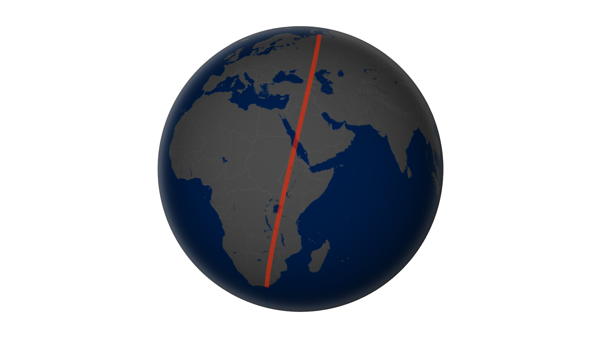
“The Landsat’s natural-color imager scanned a swath of land 185-kilometers wide and 9,000 kilometers long (120 by 6,000 miles)—an unusual, unbroken distance considering 70 percent of Earth is covered with water. That flight path—depicted on the globe below—afforded us the chance to assemble 56 still images into a seamless, flyover view of what LDCM saw on April 19, 2013. Stretching from northern Russia to South Africa, the full mosaic from the Operational Land Imager can be viewed in this video.”
We typically see remotely sensed images as a single, still rectangular grid…this stunning video shows what the image collection process would look like from the perspective of the satellite. This video is available to download in a variety of formats and resolutions.
Tags: remote sensing, geospatial, unit 1 GeoPrinciples.
See on www.youtube.com
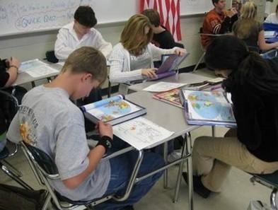
“Planning to take the Advanced Placement Human Geography exam from the College Board? Try these five suggestions for review.”
See on www.examiner.com
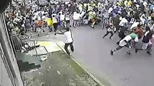
“American tragedies occur where middle America frequents every day: airplanes, business offices, marathons. Where there persists a tangible fear that this could happen to any of us. And rightfully so. Deaths and mayhem anywhere are tragic. That should always be the case. The story here is where American tragedies don’t occur. American tragedies don’t occur on the southside of Chicago or the New Orleans 9th Ward.”
This is a controversial Op-Ed article that discusses how the major axes of identity (race, class and gender) shape and intersect with the the national memory of violence and the media portrayal of violence. According the David Dennis, “The media seems to forget about New Orleans and any place that the middle class can’t easily relate to.”
See on www.guardian.co.uk
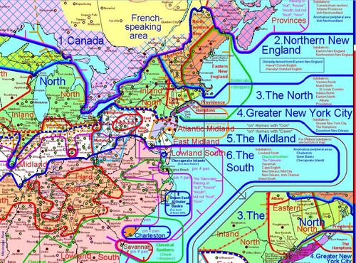
There are 8 major English dialect areas in North America, presented on the map. These are shown in blue, each with its number, on the map and in the Dialect Description Chart, and are also outlined with blue lines on the map. The many subdialects are shown in red on the map and in the chart, and are outlined with red lines on the map. All of these are listed in the margins of the map as well.
This map is incredibly busy, but the best elements of this interactive map are the links to YouTube videos of particular accents and pronunciation examples. It’s not winning any cartographic prizes but the links make the map it worth perusing given its rich detail. See also this article about the map from GeoCurrents.
Tags: language, North America.
See on aschmann.net
Rust Belt cities are hoping that immigrants can help rebuild our their shrinking communities. Washington should gear policy to helping them.
See on www.theatlantic.com

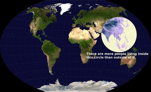
This is a fabulous map—but is the statement true?
I present this map without any context to my students and ask the question: is this statement true? How can we ascertain the truthfulness of this claim? What fact would we need to gather? This exercise sharpens their critical thinking skills and harnesses the assorted bits of regional information that they already have, and helps them evaluate the statement.
For some answers to these questions can be found here.
Tags: density, social media, East Asia, South Asia.
See on geographyeducation.org
Humanist geography, a movement within the field of human geography (itself a sub-field of geography) arose in the 1970s as a way to counter what humanists saw as a tendency to treat places as mere sites or locations. Instead, a humanist geographer would argue, the places we inhabit have as many personalities as those whose lives have intersected with them. And the stories we tell about places often say as much about who we are, as about where our feet are planted.
Anytime a geographer uses the phrase “sense of place, they owe an intellectual debt of gratitude to Yi-Fu Tuan. This article is an introduction to the man and his work that is accessible to all audiences.
Tags: place, unit 1 GeoPrinciples.
See on news.ls.wisc.edu
Scholars Online Videos feature top scholars answering a specific question in his or her field of expertise. These brief and informative videos are designed to supplement the Choices Program curricula.
In this Scholar’s Online video, Jennifer Fluri briefly answers this question: How has Afghanistan’s geography affected its history? This video nicely shows how contested international disputes have geographic dimensions to them. The very borders of Afghanistan were created out of geopolitical maneuverings.
Tags: Afghanistan, borders, political, culture, Central Asia,historical, colonialism.
See on www.choices.edu