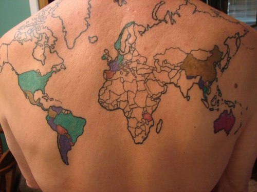
I’m not a “tattoo guy,” but this is amazing. On this map, you’ve got to earn the ink by traveling to the country.
Tags: images, art, cartography.

I’m not a “tattoo guy,” but this is amazing. On this map, you’ve got to earn the ink by traveling to the country.
Tags: images, art, cartography.
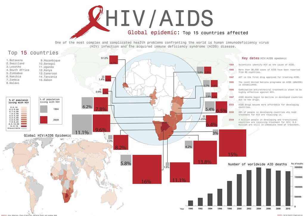
AIDS is a global issue, but clearly this impacts Sub-Saharan Africa far more than any other region.
Tags: Africa, medical, infographic, development.
See on farm9.staticflickr.com
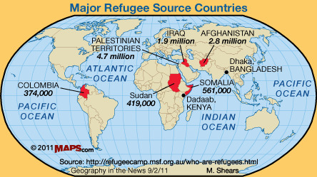
A refugee is a person who has been pushed away from their homeland and seeks refuge in another place. The United Nations High Commissioner on Refugees (UNHCR) provides a more narrow definition of a refugee as someone who flees their home country due to a “well-founded fear of being persecuted for reasons of race, religion, nationality, membership of a particular social group or political opinion.”
As Neal Lineback notes in this Geography in the News post, not all refugees are covered by this definition. Environmental refugees have been forced to leave their homes beause of soil degradation, deserticfication, flooding, drought, climate change and other environmental factors.
Tags: environment, environment depend, migration, unit 2 population.
See on www.linebackworldview.com
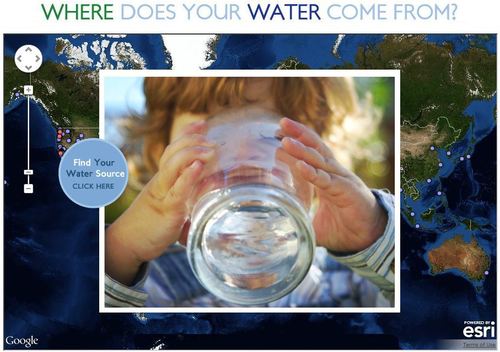
This interactive map documents where 443 million people around the world get there water (although the United States data is by far the most extensive). Most people can’t answer this question. A recent poll by The Nature Conservancy discoverd that 77% of Americans (not on private well water) don’t know where their water comes from, they just drink it. This link has videos, infographics and suggestions to promote cleaner water. This is also a fabulous example of an embedded map using ArcGIS Online to share your geospatial data with a wider audience.
Tags: GIS, water, fluvial, environment, ESRI, pollution, development, consumption, resources, mapping, environment depend, cartography, geospatial.
See on www.nature.org
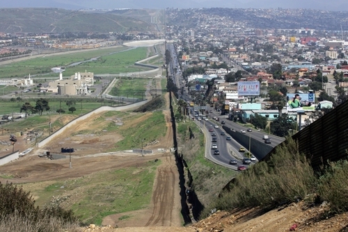
This lesson plan was specifically designed with Arizona examples and aligned to the Arizona state standards, but it be easily adapted. I saw a presentation based on this lesson at the NCGE conference as was incredibly impressed. Also, you’ll note that like this one, there are many other lesson plans freely available on the Arizona Geographic Alliance website.
Tags: K12, borders, political, landscape, migration, unit 4 political.
See on geoalliance.asu.edu
A safe way for teachers to text message students and keep in touch with parents.
I’ve tried numerous methods including Facebook groups and Twitter hashtags as ways to digitally connect with my students through emerging social media platforms. Every method seems to have a few privacy or accessibility issues and this is no expection. However, for this one, I think that the benefits outweigh the negatives and it has much greater privacy control than most. I haven’t tried this out yet, but next semester I hope to use this free way to text message all my students (and/or parents) without the privacy issues of sharing cell phone numbers or getting them to sign up for a new social media platform.
Tags: training, edtech, socialmedia, GeographyEducation.
See on www.remind101.com
The Rhode Island Geography Education Alliance seeks to promote geo-literacy here in the Ocean State. So what is geo-literacy? The National Geographic Society’s Educational team…
As the Alliance Coordinator for the state of Rhode Island, I organized these three videos (two from National Geographic) and some pictures to provide a basis for understanding what geo-literacy is and why it is important for society and within the workforce. In the spirit of sharing, I thought I’d share these links beyond the borders of Rhode Island.
Tags: GeographyEducation, NationalGeographic, geo-inspiration, RhodeIsland.
See on rigea.org
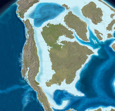
States in the Deep South traditionally vote Republican in every presidential election. However, a string of “blue” counties curve through Mississippi, Alabama and Georgia.
Question to ponder: How does the physical geography of a region impact the human geography of a place? Using this example, does the environment completely determine the cultural outcomes of the region? To what extent does one impact the other?
Tags: physical, political, environment, unit 4 political.
See on www.npr.org
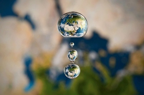
There are many amazing examples of artists who turn to cartography and geography for inspiration. Whether through the lens of a camera, paint, …
This series of cartographically-inspired art works changes how we look at maps. Some of these artists also make us think of places that are on the Earth as explicitly “mappable” features. I think the Google Maps push-pin in the city center is my favorite. Which do you prefer?
Tags: art, mapping, place, cartography.
See on gislounge.com