Search

GEOGRAPHY EDUCATION

Supporting geography educators everywhere with current digital resources.

Category

Uncategorized

Why everyone should take a geography class, especially now

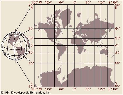
Geographical literacy remains vital—particularly for those of us who live in (for the time being at least) the world’s preeminent military and economic superpower. Geography is necessary for understanding why the overthrow of a government in Libya contributed to an unprecedented surge of migrants into Europe, why Ukraine has been split between East and West amid its conflict with Russia, and why China’s neighbors are alarmed at the new islands under construction in the South China Sea. And as we learned during last year’s Ebola panic, an understanding of African geography could have helped explain why an outbreak in West Africa should not lead to the quarantining of people from Kenya or Tanzania. In the years to come, as the effects of climate change on everything from sea level rise to deforestation to drought quite literally reshape the world we live in, an understanding of geography will be necessary for mitigating and adapting to the consequences.

Source: www.slate.com

A basic understanding of geography is a prerequisite for any informed citizen, and globalization means that is even more important than ever.  

TagseducationK12geography education.

ConnectED Geography Webinar: Students can use, make, and share online maps for free

Join K-12 Esri Education Manager, Charlie Fitzpatrick, for this upcoming partnered webinar that is open and free to everyone! Online maps are easy, fun, and powerful. Anyone with an internet connection can get started in seconds, learn new content constantly, and build toward college, career, and civic life. Any connected device, anytime, anywhere! This NCGE webinar is designed for those just wondering how to start, with a special ConnectED offer from Esri for US K12 schools. Register now!
Wed, Oct 7, 2015 8:00PM – 9:00PM EDT
NCGE offers regular webinars for members; look at the 2015-2016 NCGE Webinar Season Schedule

Source: attendee.gotowebinar.com

Do it for Denmark, Take II

Spies Travel is joining forces with wannabe grandmas in the fight against Denmark’s low birth rate. Introducing Spies Parent Purchase™: Send your child on an active holiday and get a grandchild.

Source: www.youtube.com

Not all countries are concerned about overpopulation;  Countries like Japan are in steep decline in terms of their population.  Denmark is a country that is seeking to to encourage higher fertility rates; this travel company is using this salacious ad (as a sequel to Do it for Denmark) to promote the it and themselves, but there is some actual demographic analysis in there). Singapore’s National Night was another innovative campaign to boost fertility rates, but they also have a less steamy campaign entitled “Maybe Baby?”

Tag: declining populations.

Can you identify these world cities from their street plans alone?

We’ve stripped out the street names and lost the labels – but can you still recognise the cities from their aerial views?

Source: www.theguardian.com

This is a fun map quiz that is part memory, but also relies on pattern recognition to see if you can understand the urban morphology that shaped these places.  I got 11 out of 13…can anybody top that?  I’m sure someone can; give it a shot.  

Tagsplanning, architecture, urban, regions, trivia, games.

Wind Forecast

Ubercool wind animation all over the world. Wind and weather forecast for kiters, surfers, pilots and anyone else.

Source: www.windyty.com

With people on the East Coast concerned about the possible trajectories for Hurricane Joaquin, I think it is the right time to share this interactive map.  In the past I shared a dynamic map of near-live wind data for the United States and a mesmerizing digital globe with wind data.  This new one though, includes multiple meteorological layers with forecasts for the next two weeks…very cool.     


Tagsphysical, weather and climate, mapping, visualization.

Outsiders often using the Amish name for marketing

“In and around Amish country, it’s easy to find countless stores and websites advertising Amish quilts, Amish candy and Amish crafts. But though Mr. Zook is Amish, it would be impossible to tell from the name of his Evansburg farm, Maple Run, or his products, whose homemade labels make no mention of their maker’s religion.  In fact, it’s a good bet that if the word ‘Amish’ appears on a store or a product, the Amish themselves didn’t put it there. Experts and Amish alike say that the name, used as a marketing tool, is almost exclusively the domain of the non-Amish.”

Source: www.post-gazette.com

While being an interesting topic in and of itself, this article is also an way way to introduce various concepts of cultural geography: folk culture, cultural commodification and cultural appropriation.


Questions to Ponder: Why is there cultural and economic cachet in being affiliated with the term ‘Amish’ in the United States today? When do you feel cultural commodification is ‘crossing the line’ or is everything marketable fair game?  What are other examples of cultural appropriation that you can think of? 

Tagsfolk cultureseconomic, culture, religion, technology, popular culture.

A Graphic Guide to Cemetery Symbolism

To convey the lives of the people buried beneath them, and the expectations for what comes after death, symbolism has long been part of tombstones. Below is our guide to some of the most prevalent cemetery symbols. Take it along on your next wander through the necropolis!

Tag: cemetery, monumentslandscape.

Source: www.atlasobscura.com

A good friend of mine always calls October 1st, the first day of Halloween.  Enjoy exploring the geography of cemeteries!

Interactive Gnomonic Map

Source: bl.ocks.org

As stated on USGS map projections page: “[Gnomonic maps are] used by some navigators to find the shortest path between two points.  Any straight line drawn on the map is on a great circle, but directions are true only from center point of projection.”  This interactive is a very fun way  to visualize this and to understand distortion.    

Why Mercator for the Web? Isn’t the Mercator bad?

“As you may know, Google Maps uses the Mercator projection. So do other Web mapping services, such as Bing Maps and MapQuest. Over the years I’ve encountered antipathy toward the use of the Web Mercator from map projection people. I know of two distinct schools of opposition. One school, consisting of cartographic folks and map aficionados, thinks the Mercator projection is ‘bad’: The projection misrepresents relative sizes across the globe and cannot even show the poles, they are so inflated. The other school, consisting of geodesy folks, thinks mapping services have corrupted the Mercator projection, whether by using the wrong formulæ for it or by using the wrong coordinate system for it.”

Source: www.mapthematics.com

In this article you will find a thoughtful discussion of the reasons why the Mercator projection is disliked by many, but still so prevalent.  For more resources on understanding map projections, click here


Tags: mapping, visualization, map projections, cartography, perspective, unit 1 Geoprinciples.

Create a free website or blog at WordPress.com.

Up ↑