Search

GEOGRAPHY EDUCATION

Supporting geography educators everywhere with current digital resources.

Tag

cartography

State Borders

Source: xkcd.com

I imagine most geographers have wanted to tinker with state or international borders to ‘fix them’ in one way or another…but if any ‘correction’ were to be made, whose criteria would be used?  Which people in which regions would be upset by the changes?  Historical inertia is a power force in maintaining the status quo. When France was preparing to consolidate it’s administrative regions, 68% recognized that consolidating regional administration would be more efficient but 77% didn’t want it to impact their own local region.


Tags: XKCD, art, mapping, cartography, borders, political.

The last globemakers

Peter Bellerby is one of the last artisan globemakers on earth. But now, he’s teaching an entirely new generation of artists the secrets of crafting entire worlds by hand.

Source: www.youtube.com

Yes, these globes are precise archives filled with geospatial data and locational information–however, that pales in comparison to the artistic brilliance of the globes. These hand-crafted globes are truly works of art.  Marvel at the merger of mathematical precision and artistic design that makes a globe such as these a cartographic gem.  If anybody want to get me a Christmas present, you know that I love cartographic gifts.  FUTURE WATCHING: Here is the longer video of the Bellerby Globes being produced.     


Tags: cartography, visualization, mapping, artgeo-inspiration.

Disaster Mapping: Hurricane Irma, Mexico Earthquake and Bangladesh Floods

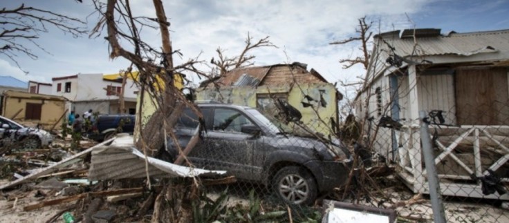
This week has seen disasters and destruction on an unprecedented scale, and the HOT Community has activated to respond. Hurricane Irma is the largest Hurricane ever recorded, and has torn death and destruction through the Caribbean. Destruction on some islands is estimated at 95%, affecting the lives of 1.2 million so far, and on track to cause severe destruction across the entire Florida State, where mass evacuation is currently underway. Barbuda’s prime minister, Gaston Browne, described the damage as absolutely heart-wrenching. ‘The island is literally under water and barely habitable,’ Browne said. ‘About 95% of properties are damaged, there is a serious threat of disease. Additionally, those already affected by Irma fear a second brutal battering by Hurricane Jose.'”

Source: www.hotosm.org

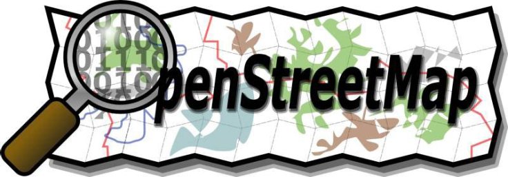
Want to see geographic knowledge and geospatial skills in action?  Crowd-sourced mapping is increasingly an important resource during an emergency.  Poorer places are often not as well mapped out by the commercial cartographic organizations and these are oftentimes the places that are most vulnerable to natural disasters.  Relief agencies depend on mapping platforms to handle the logistics of administering aid and assessing the extent of the damage and rely on these crowd-sourced data sets.  My students and I join OpenStreetMap (OSM) projects, especially when there is a major humanitarian need…it’s a great way to make service learning and geospatial technologies come together. The projects that are marked urgent by the Red Cross are all in Haiti right now.  Here are is a video playlist that explains the project and how you can help if you are new to OpenStreetMap (OSM).


Tags: disasters, mapping, edtechSTEM, weather and climate.

Mapping Coastal Flood Risk Lags Behind Sea Level Rise

Federal maps help determine who on the coast must buy flood insurance, but many don’t include the latest data. Maryland is now making its own flood maps, so homeowners can see if they’re at risk.

Source: www.npr.org

Geographic themes are overflowing (it was an unintended pun, but I’ll just let that wash over you) in this podcast.  I suggest playing a game early in the year/semester called “find the geography.”  What geographic theme/content areas will your students find in this podcast? 


Tagspodcast, mapping, cartography, climate change, environment, watercoastal,  urban, planningurban ecology.

Boston schools ditch conventional world maps in favor of this one

Social studies classrooms throughout the Boston public school system are getting an upgrade some 448 years in the making.

Source: www.bostonglobe.com

Personally, I’m not a fan of this decision, but it’s as if they watched the classic West Wing clip and decided to roll with it. I think that the Peters projection map is better than the Mercator for most educational applications, but it isn’t the “right, best, or true” map projection.  Many viral videos comparing the two love to exaggerate and say things like “The maps you use are lying to you” or “the world is nothing like you’ve ever seen.”  Yes, Mercator maps distorts relative size, but it isn’t a “wrong” map anymore than the Peters projection.  All maps have distortion and map readers need to under that all maps are a mathematical representation of the Earth.  


Tags: mapping, visualization, map projections, cartography, perspectiveeducation, geography, geography educationBoston.

U.S.G.S. Topographical Maps

Think of them not as cartographic abstractions, but as incredibly affordable Pollocks.

Source: www.nytimes.com

Good cartography lies at the intersection of rigorous scientific data display and a aesthetic touch of beauty.  This article is an ode to the beauty of USGS topographic maps as affordable pieces of art.  Geography students that start their own mapping projects need to recognize that good cartographic work often needs to be both an art and a science to fit the needs of their intended audience. 


Tags: cartography, visualization, mapping, artgeo-inspiration.

The Geography Teacher’s Introduction to OpenStreetMap

“Wed, Mar 15, 2017 8:00 PM – 9:00 PM EDT, the NCGE will be offering a free webinar for educators on the OpenStreetMap project and how you can incorporate it into your class.”

Source: attendee.gotowebinar.com

My students and I join OpenStreetMap (OSM) projects, especially when there is a major humanitarian need…it’s a great way to make service learning and geospatial technologies come together. If you are interested learning more about OSM projects for the classroom, sign up for this NCGE webinar seminar as soon as possible, since this event is right around the corner (the webinar program is one of the many great reasons to become a member of NCGE). 


TagsNCGE, mappingedtech, cartography, geospatial, disasters, STEM.


This computer programmer solved gerrymandering in his spare time

We could take human error out of the redistricting process entirely. Why don’t we?

Source: www.washingtonpost.com

This computer programmer (code word in the newspapers for geographers using GIS) has created a way to take the human element out of the redistricting process.  Dividing places into separate, formal regions is an important task, one that often times requires an intimate knowledge of the place, it’s cultural, economic and physical characteristics.  That’s how I would want things to been done in a perfect world, but partisan chicanery has led to so many gerrymandered districts that the human touch is what many of us fear more than a cold, impersonal division that does not take place, history, and community into account.    


Questions to Ponder: Do you trust the politicians that are in charge of your state to create better districts than computer-generated districts that are optimized for compactness?  What are some of the potential limitations of compact districts?  Would an independent committee/bipartisan group do a better job? How does the Voting Rights Act complicate the redistricting process?    


Tags: gerrymandering, politicalmapping, cartography, GIS, unit 4 political.

How the U.S. Air Force Mapped the World at the Dawn of the Cold War

One specialized unit gathered data that could guide a missile to a target thousands of miles away.


The work of the 1370th bridged a crucial gap in the history of military technology. By the late 1950s, both the United States and the Soviet Union had developed intercontinental ballistic missiles, but satellite navigation systems like GPS weren’t yet up and running. That left military planners with a huge challenge: how to program a missile to hit a target on the other side of the world. Even a tiny mistake could be disastrous.


Tags: mapping, cartography, technology, historical.

Source: news.nationalgeographic.com

Blog at WordPress.com.

Up ↑