Environmental artist J Henry Fair captures the beauty and destruction of industrial sites to illustrate the hidden impacts of the things we buy – the polluted air, destroyed habitats and the invisible carbon heating the planet
Source: www.theguardian.com
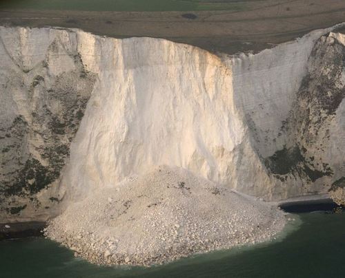
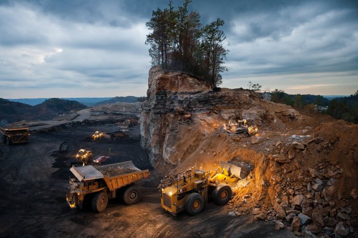
This artistic portrayal shows the extent of the massive modifications we’ve made to the landscape with some striking examples. Pictured above is one of 17 images in this article that promotes the launch of the new book entitled, Industrial Scars: the Environmental Cost of Consumption. In the image above we see mountaintop coal mining in West Virginia. “This lonely stand of trees disappeared in barely a day. The small bulldozer on the upper level pushes loose material down to the loader, which scoops it up into the next earth mover in line, which will in turn dump it into a nearby ‘valley fill’, burying the stream there.” This might be the most beautiful and ugly set of images that you’ll see today.
Tags: pollution, industry, sustainability, images, art, landscape, unit 6 industry.