Search

GEOGRAPHY EDUCATION

Supporting geography educators everywhere with current digital resources.

A Graphic Guide to Cemetery Symbolism

To convey the lives of the people buried beneath them, and the expectations for what comes after death, symbolism has long been part of tombstones. Below is our guide to some of the most prevalent cemetery symbols. Take it along on your next wander through the necropolis!

Tag: cemetery, monumentslandscape.

Source: www.atlasobscura.com

A good friend of mine always calls October 1st, the first day of Halloween.  Enjoy exploring the geography of cemeteries!

Interactive Gnomonic Map

Source: bl.ocks.org

As stated on USGS map projections page: “[Gnomonic maps are] used by some navigators to find the shortest path between two points.  Any straight line drawn on the map is on a great circle, but directions are true only from center point of projection.”  This interactive is a very fun way  to visualize this and to understand distortion.    

Why Mercator for the Web? Isn’t the Mercator bad?

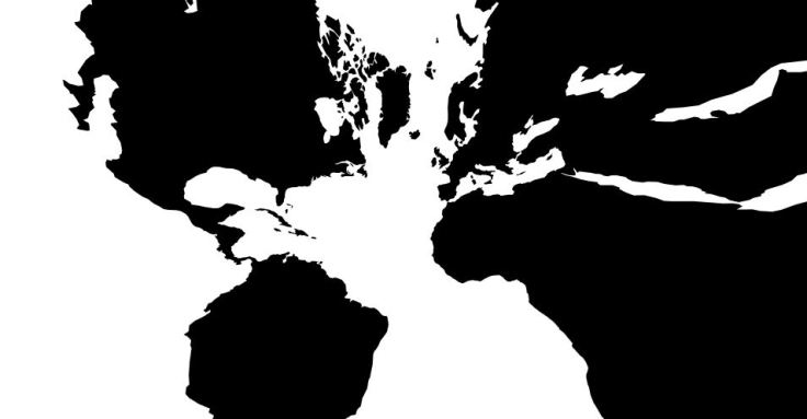
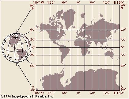
“As you may know, Google Maps uses the Mercator projection. So do other Web mapping services, such as Bing Maps and MapQuest. Over the years I’ve encountered antipathy toward the use of the Web Mercator from map projection people. I know of two distinct schools of opposition. One school, consisting of cartographic folks and map aficionados, thinks the Mercator projection is ‘bad’: The projection misrepresents relative sizes across the globe and cannot even show the poles, they are so inflated. The other school, consisting of geodesy folks, thinks mapping services have corrupted the Mercator projection, whether by using the wrong formulæ for it or by using the wrong coordinate system for it.”

Source: www.mapthematics.com

In this article you will find a thoughtful discussion of the reasons why the Mercator projection is disliked by many, but still so prevalent.  For more resources on understanding map projections, click here


Tags: mapping, visualization, map projections, cartography, perspective, unit 1 Geoprinciples.

Reefer Madness

“There are around 6,000 cargo vessels out on the ocean right now, carrying 20,000,000 shipping containers, which are delivering most of the products you see around you. And among all the containers are a special subset of temperature-controlled units known in the global cargo industry, in all seriousness, as reefers.

70% of what we eat passes through the global cold chain, a series of artificially-cooled spaces, which is where the reefer comes into play.”

Source: 99percentinvisible.org

I have written in the past about how containerization has remade the world we live in, but not much about the role of the refrigerated container (reefer).  So many economic geographies and agricultural geographies in the our consumer-based society hinge of this technological innovation.  This is yet another podcast from 99 Percent Invisible that is rich in geographic content.  


Tags: transportationfood distributiontechnology, globalization, diffusion, industry, economic, podcast.

30 charts and maps that explain China today

“China’s mind-boggling size, economy and history, visualized.””

Source: www.washingtonpost.com

This article is an enjoyable hodge-podge of maps, charts and graphs that collectively attempt to explain China’s role the world today.  This is similar to, and complements this article which answers 7 question about China and the United States.  


Tags: economic, China, development.

Food Processing

“Trying to break a whole lamb into steaks and roasts in just a little over three minutes.”

Source: www.youtube.com

Where does our food come from?  As the global population becomes more urban, the percentage of our population that is more disconnected from their food sources grows.  Additionally, our economic system works to actively separate consumers from the unseemly parts of the commodity chains, in hopes that our propensity to spend money on more goods won’t decline.  All animals killed for human consumption go through some sort of butchering process before they become a meat product that we might recognize in the grocery store. 


Tags: foodeconomicfood production, agribusiness.

Syria: Epicenter of a Deepening Refugee Crisis

Thousands of refugees, many of them fleeing the brutal conflict in Syria, are streaming across Europe in search of safety and security.

Source: storymaps.esri.com

If you were hoping someone would make an interactive Story Map with 8 maps on the global refugee crisis, then this is absolutely for you.  While some of the data is centered on Syria and Europe, other maps are global in focus.  This is a VERY good example of a great web map.  

Tags: GIS, ESRI, mapping, cartography, geospatial, edtech, Syria, political, refugees.

Practicing an Open Mind

“Travel is fatal to prejudice, bigotry, and narrow-mindedness, and many of our people need it sorely on these accounts. Broad, wholesome, charitable views of men and things cannot be acquired by vegetating in one little corner of the earth all one’s lifetime.”

Tags: place, tourism, geo-inspiration.

Source: www.familytrek.org

When China Rules the Sea

The United States is no longer the world’s only global naval power.

Why would China go to the trouble and expense of mounting an expedition to the northern climes in the Western Hemisphere? Because it sees value in staging a presence in distant waters. And because it can: Beijing no longer depends completely on its oceangoing battle fleet to ward off threats in China’s seas. It can now rain long-range precision firepower on enemy fleets from land. Ergo, the People’s Liberation Army Navy (PLAN) fleet can cruise the far reaches of the Pacific and Indian oceans or even beyond, without forfeiting China’s interests in waters close to home.  For China, the upsides of far-ranging maritime strategy are many and compelling, the downsides fewer and fewer.


Tagsgeopolitics, political, waterChina, East Asia.

Source: foreignpolicy.com

Blog at WordPress.com.

Up ↑