Search

GEOGRAPHY EDUCATION

Supporting geography educators everywhere with current digital resources.

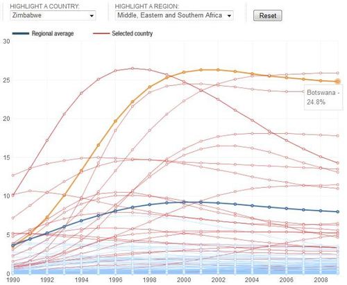
The Spread of AIDS

A handful of AIDS cases were first recognized in the U.S. at the beginning of the 1980s. By 1990, there was a pandemic. In 1997, more than 3 million people became newly infected with HIV.

Seth Dixon, Ph.D.‘s insight:

The spread of AIDS/HIV since the 1980s has varied greatly over time and space.  The red lines represent Sub-Saharan countries and the dark blue line on this interactive is the regional average of Sub-Saharan African countries.  The regional trend was on the rise at the end of the 20th century, but is now on a slight decline (but still an major impact on the continent).  Countries such as Botswana and Zimbabwe have made some significant strides in limiting the spread of AIDS (Zimbabwe is the country that ‘peaked’ in 1997 and has had the steepest decline).

Tags: Africa, medical, development, infographic, diffusion.

See on www.npr.org
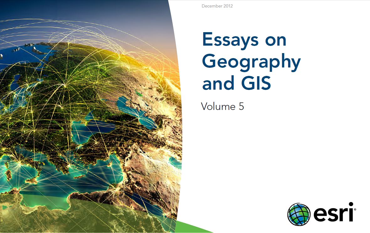
Essays on Geography and GIS

Seth Dixon, Ph.D.‘s insight:

This set of 19 short essays (around 3-4 pages each) is a great supplemental text.  I am eager to read them and other resources in the ESRI library.

Tags: GIS, ESRI, mapping, cartography, geospatial, edtech, geography education, unit 1 GeoPrinciples.

See on www.esri.com

ESRI book

What we can learn from Mexico

For more What in the World, watch GPS on Sundays at 10 a.m. and 1 p.m. ET.

By Global Public Square staff

Earlier this month, the president told a newspaper the solution to partisanship is politics and more politics.

Seth Dixon, Ph.D.‘s insight:

Quick facts about the “new” Mexico:

  • Mexico has more international trade deals (44) than any other country.
  • Mexico exports more manufactured products than all the other countries in Latin America combined
  • Mexico’s GDP is expected to grow by nearly 4% this year, twice as fast as Brazil (and the USA).
  • Mexico’s average income (PPP) is higher than China, India Russia or Brazil (Mexico could be a BRIC country if it didn’t ruin the acronym).

Does that help in explaining why Mexican aren’t leaving to go to the United States?  In fact, more Mexicans are leaving the United States than entering in a clear example of changing push and pull factors.

See on globalpublicsquare.blogs.cnn.com

Mongolia’s nomads

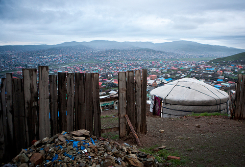
Through his Vanishing Cultures Project photographer Taylor Weidman documents threatened ways of life.  About his work in Mongolia, he states: “Mongolian pastoral herders make up one of the world’s largest remaining nomadic cultures. For millennia they have lived on the steppes, grazing their livestock on the lush grasslands. But today, their traditional way of life is at risk on multiple fronts. Alongside a rapidly changing economic landscape, climate change and desertification are also threatening nomadic life, killing both herds and grazing land.”

In times of ecological hardships and global economic restructuring, many children of nomadic herders are seeking employment out of the rural areas and in the urban environment.  The cultural change that this represents is for Mongolia enormous and is captured wonderfully in this photo gallery.  Pictured above are the ger (yurt) camps that ring the capital city Ulaanbaatar.  Ulaanbaatar houses a permanent population of displaced nomads. During the winter, Ulaanbaatar is the second most air-polluted capital in the world due largely to coal burning.

Tags: Mongolia, images, indigenous, culture, globalization.  

See on www.boston.com

A Poacher’s Redemption

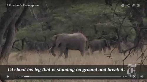
Jeffrey Gettleman, The Times’s Nairobi bureau chief, reports on how Kenya’s wildlife conservation corps is learning from a reformed poacher how to counter the growing threat to elephants.

Seth Dixon, Ph.D.‘s insight:

In Somalia, former pirates are helping to patrol the coasts to prevent piracy.  This idea of reforming and recruiting past criminals is also seen in Kenya as former poachers are trying to protect elephants that are essential to the local ecology as well as the tourism-driven economy.   In addition to the attached video is this article which expands on these issues.

Tags: biogeography, tourism, Africa, consumption, resources, ecology, Kenya.

See on www.nytimes.com

U.S. Census Dotmap

Seth Dixon, Ph.D.‘s insight:

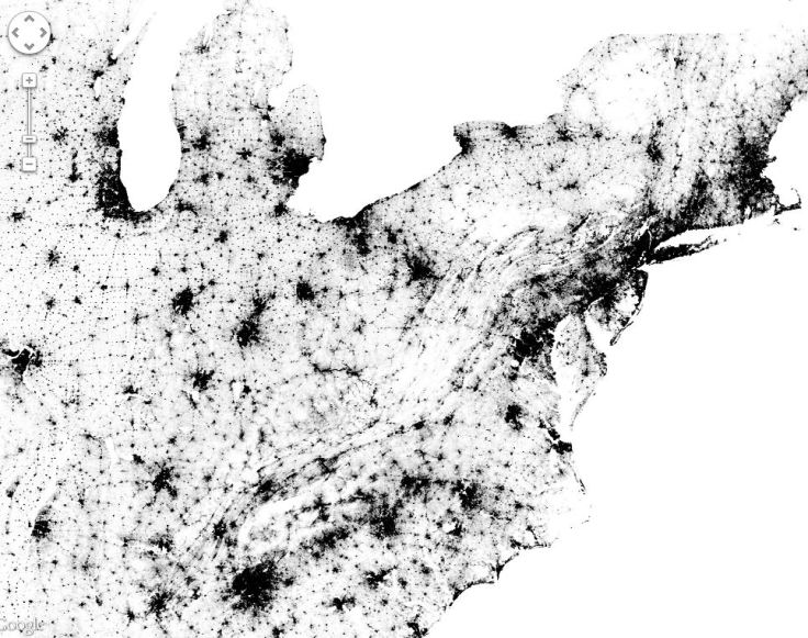
This interactive dot distribution map of the United States 2010 census data has many great applications.  The conversation can focus on the symbology of the map (for example, this could lead to a discussion of the advantages and disadvantages of a dot distribution maps) or notice how the certain physical landforms are visible for either their high or low population density.  One of the advantages of this map is that it uses census data at the block level.  This means that the user can visualize distinct scale-dependent patterns.  Sharp divisions (e.g.-urban vs. rural) might have less of a distinct edge as you zoom in.

UPDATE: This map now includes Canadian census data as well as the United States. 

Tags: cartography, technology, mapping, visualization, population, density.

See on bmander.com

Census Dot Map

NCGE’s December 2012 Perspective

Seth Dixon, Ph.D.‘s insight:

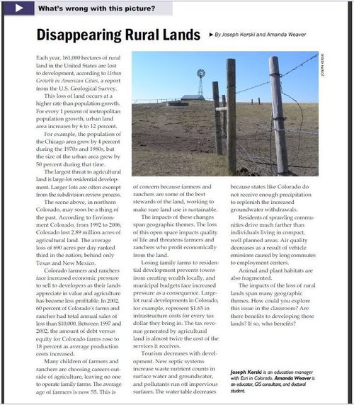
This screenshot is of a great article in this month’s edition of NCGE’s newsletter focusing on rural lands and recent changes to rural systems.  Follow the link for the whole newsletter including an edition of Geography in the News on Siberia’s Northern Railway.    

Tagsrural, NCGE, unit 5 agriculture.

See on share.snacktools.com

Rapes Cases Show Clash Between Old and New India

A boom and social change are pitting young working women in the city against men from conservative villages.

Seth Dixon, Ph.D.‘s insight:

The recent resurgence of this issue had me looking through the archives and stumbled upon this 2011 article.  As urban expansion is booming in many Indian cities, the modern city expands into the countryside.  The cultural values of these two demographic groups are quite distinct.  Young, educated women are part of the modern cities’ workforce but in many conservative, traditional Indian villages, women working outside the home are seen as “lacking in virtue.”  In many of the recent gang rape cases, the perpetrators are less educated young men from surrounding villages and the victims are well-educated young working women that are a part of the new city.    

Public spaces, especially at night, are seen as masculine spaces in most traditional societies.  One of the mothers of an accused rapist succinctly explained this mindset thusly: “If these girls roam around openly like this, then the boys will make mistakes.”  This is seen as ‘Eve teasing,’ where women are perceived as responsible for the violence committed against them to maintain social order

This other NY Times article op-ed states, “India must work on changing a culture in which women are routinely devalued. Many are betrothed against their will as child brides, and many suffer cruelly, including acid attacks and burning, at the hands of husbands and family members.  India, a rising economic power and the world’s largest democracy, can never reach its full potential if half its population lives in fear of unspeakable violence.”

Tags: India, migration, South Asia, culture, urban, folk culture, megacities.

See on www.nytimes.com

The Best Posts for 2012

Global news with a spatial perspective: resources for educators and the inherently inquisitive. http://geographyeducation.org

Seth Dixon, Ph.D.‘s insight:

This list is a combination of two types of posts.  Some represent the best posts of Geography Education during 2012 as voted by you the viewers (measured by page views) and I’ve added a few that I feel where my ‘favorite finds’ of the year.  For more favorites, you can see the best of 2011.


Tags: best of 2012, zbestofzbest, geo-inspiration.

See on www.scoop.it

Best

Blog at WordPress.com.

Up ↑